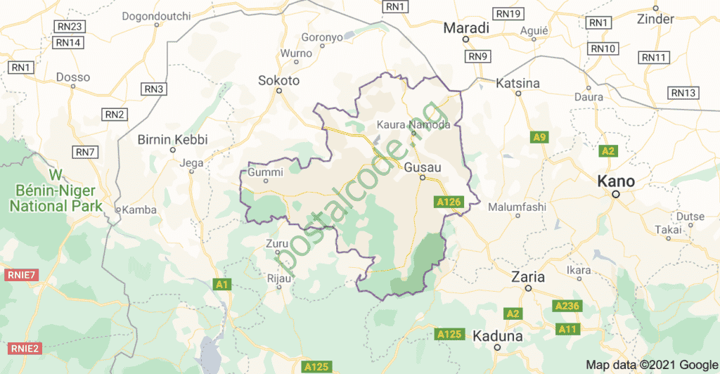
Zamfara State, located in the northwestern region of Nigeria, is one of the thirty-six (36) states that make up Nigeria. It is a state rich in cultural heritage, historical significance, and diverse economic activities. Known for its agricultural prowess and mineral resources, Zamfara plays a pivotal role in the socio-economic landscape of Nigeria.

Efficient postal services are vital to support the state’s communication, business operations, and administrative functions. The postal code system is a crucial aspect of this infrastructure, ensuring that mail and packages are accurately and promptly delivered to their intended destinations.
This article provides a comprehensive list of postal codes for various towns, cities, and local government areas (LGAs) within Zamfara State. Whether you are a resident, business owner, or postal service provider, understanding and using the correct postal codes is essential for maintaining seamless communication and logistical operations.
From the bustling state capital of Gusau to the smaller, yet significant, towns and villages spread across the state, each area is assigned a unique postal code that aids in the efficient sorting and delivery of mail. This detailed postal code list will serve as a valuable resource for anyone looking to navigate the postal system within Zamfara State, ensuring that correspondence and packages reach their destinations without unnecessary delays.
Zamfara State Overview:
- Total land area: 37,931 Km2
- Capital: Gusau
- Local Government Areas: 14 LGAs: Zurmi, Maradun, Talata Mafara, Gusau, Kaura Namoda, Bungudu, Chafe, Maru, Anka, Bukkuyum, Gummi, Bakura, Birin Magaji/Kiyaw and Shinkafi.
- Population: 5,307,154 (Male- 2,706,649 and Female- 2,600,506)
- Vegetation: Hot Semi-arid and Tropical Savannah
- Major crops: Millet, Guinea corn, Maize, Rice, Potato, Wheat, Tomato, Groundnut, Cotton, Tobacco, and Beans.
- Solid minerals: Gold, Iron-Ore, Copper, Tantalite, Manganese
Zamfara consists of fourteen (14) Local Government Areas (LGAs) with wards and districts that use different postal or zip codes.
Click on any of the following locations in Zamfara state to reveal their postal code/zip code:
- Anka LGA Postal Code
- Bakura LGA Postal Code
- Birnin Magaji/Kiyaw LGA Postal Code
- Bukkuyum LGA Postal Code
- Bungudu LGA Postal Code
- Tsafe LGA Postal Code
- Gummi LGA Postal Code
- Gusau LGA Postal Code
- Kaura Namoda LGA Postal Code
- Maradun LGA Postal Code
- Maru LGA Postal Code
- Shinkafi LGA Postal Code
- Talata Mafara LGA Postal Code
- Zurmi LGA Postal Code
NOTE: Currently, the data released for the Zamfara post/zip code is limited. Right now, we can only provide the postal code or zip code for a few LGAs. This post will be updated as soon as codes are designated for the remaining parts of the state.
Want to check the postal code for a different location? It’s very simple. Visit our homepage and follow the instructions you find there to do so.
See difference between Postal code and Zip code HERE.
See the List Of Post Offices In Zamfara State, Nigeria With Addresses
