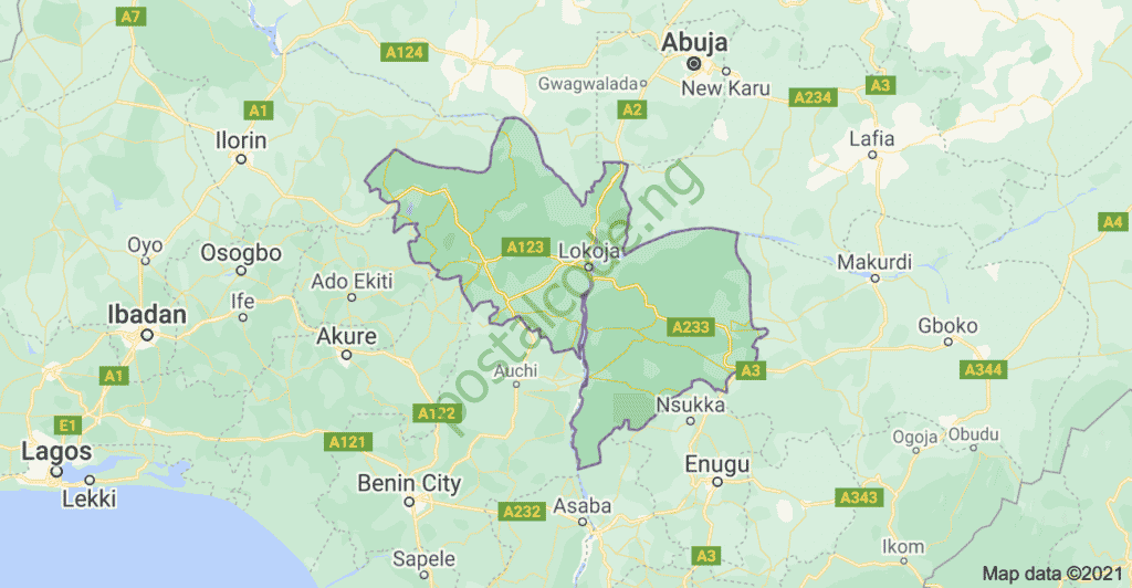
Kogi State, located in the central region of Nigeria, is divided into 22 Local Government Areas (LGAs). Each LGA has its administrative headquarters where local governance and decision-making processes take place.

image source: google maps
Kogi State Overview
- Total Land Area: 27,747 Km²
- Capital: Lokoja
- Population: 4,750,115 (Male: 2,422,559; Female: 2,327,557)
- Vegetation: Tropical Savannah
- Major Crops: Cassava, Rice, Cashew, Coffee, Cocoa, Palm Oil, Groundnuts, Maize, Yam, and Melon
- Solid Minerals: Limestone, Iron Ore, Marble, and Gemstones
Kogi State is divided into four agricultural zones: Aiyetoro-Gbede, Anyigba, Koton-Karfe, and Alloma.
Here is a list of the 22 Local Government Areas in Kogi State:
Kogi State L.G.A
- Adavi LGA
- Ajaokuta LGA
- Ankpa LGA
- Bassa LGA
- Dekina LGA
- Ibaji LGA
- Idah LGA
- Igalamela Odolu LGA
- Ijumu LGA
- Kabba/Bunu LGA
- Koton Karfe LGA
- Kogi LGA
- Lokoja LGA
- Mopa Muro LGA
- Ofu LGA
- Ogori/Magongo LGA
- Okehi LGA
- Okene LGA
- Olamaboro LGA
- Omala LGA
- Yagba East LGA
- Yagba West L.G.A
List of Kogi State’s 22 Local Government Areas with their Headquarters
Here is a comprehensive table listing all the LGAs in Kogi State along with their headquarters:
| LGA Name | Headquarters |
|---|---|
| Adavi | Ogaminana |
| Ajaokuta | Ajaokuta |
| Ankpa | Ankpa |
| Bassa | Oguma |
| Dekina | Dekina |
| Ibaji | Onyedega |
| Idah | Idah |
| Igalamela-Odolu | Ajaka |
| Ijumu | Ayere |
| Kabba/Bunu | Kabba |
| Kogi | Koton Karfe |
| Lokoja | Lokoja |
| Mopa-Muro | Mopa |
| Ofu | Ugwalawo |
| Ogori/Magongo | Ogori |
| Okehi | Obangede |
| Okene | Okene |
| Olamaboro | Okpo |
| Omala | Abejukolo |
| Yagba East | Isanlu |
| Yagba West | Odo-Ere |
It’s important to note that each LGA has its own unique characteristics, cultural heritage, and natural resources. Kogi State is known for its diverse ethnic groups, including the Igala, Ebira, Bassa, Nupe, and Yoruba, which contribute to the cultural richness of the state.
If you would like to learn more about each Local Government Area and its history, economy, or tourist attractions, you can visit the official Kogi State Government website at www.kogistate.gov.ng. Additionally, the National Population Commission of Nigeria provides valuable demographic information about each LGA on its official website at www.population.gov.ng.
The LGAs in Kogi State play a crucial role in promoting grassroots development, delivering important services, and ensuring effective governance at the local level. These administrative units are vital for promoting social welfare, infrastructure development, healthcare delivery, education, and agriculture in the state.
It’s important to acknowledge the efforts of the government, traditional rulers, community leaders, and residents in each LGA in working towards the sustainable development of Kogi State. Their collective contributions are instrumental in shaping the future of the state and improving the quality of life for its inhabitants.
As Kogi State continues to grow and evolve, it is important to stay updated on the progress and development initiatives undertaken by each LGA. This knowledge can help promote collaboration, awareness, and participation in efforts aimed at fostering sustainable development and improving the overall well-being of the people in Kogi State.
Disclaimer: The information provided in this article is based on the knowledge cutoff of January 2024. It is always recommended to cross-reference with up-to-date sources for the most accurate and current information.
References:
- Kogi State Government website: www.kogistate.gov.ng
- National Population Commission of Nigeria website: www.population.gov.ng
