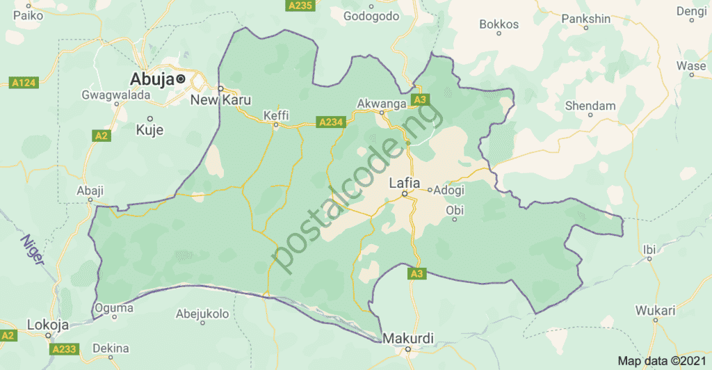
Nasarawa State is situated in Nigeria’s North-Central region. Established on October 1, 1996, the state’s capital is Lafia. Nasarawa comprises thirteen (13) Local Government Areas (LGAs), each with its own administrative headquarters.

image source: google maps
Nasarawa State Overview
Nasarawa State spans a total land area of 28,735 square kilometers and has its capital in Lafia. The state’s population is 2,679,433, comprising 1,366,511 males and 1,312,922 females. The region is characterized by Guinea Savannah vegetation.
Nasarawa State is known for its diverse agricultural output, including major crops such as yam, maize, cassava, groundnut, garden eggs, rice, sorghum, sugarcane, pepper, cowpea, benniseed, melon, soybeans, cashew nuts, sesame seeds, and shea butter.
The state is also rich in solid minerals, including barite, coal, clay, lead-zinc, salt, gemstones, silica sand, iron ore, granite, tantalite, marble, mica, cassiterite, limestone, and aquamarine.
For agricultural administration, Nasarawa State is divided into three zones: the Southern zone includes Obi, Awe, and Doma; the Western zone comprises Toto, Kokona, and Karu; and the Northern zone covers Nasarawa Eggon, Akwanga, and Wamba.
Each of the Nasarawa’s 13 Local Government Areas (LGAs) has its own unique characteristics and attributes. These LGAs play a crucial role in the governance and administration of the state. Here is a list of the 13 Local Government Areas in Nasarawa State:
- Akwanga LGA
- Awe LGA
- Doma LGA
- Karu LGA
- Keana LGA
- Keffi LGA
- Kokona LGA
- Lafia LGA
- Nasarawa LGA
- Nasarawa Egon LGA
- Obi LGA
- Toto LGA
- Wamba LGA
List of Nasarawa State’s 13 Local Government Areas with their Headquarters
Here is a comprehensive table listing all the LGAs in Nasarawa State along with their headquarters:
| LGA | Headquarters |
|---|---|
| Akwanga | Akwanga |
| Awe | Awe |
| Doma | Doma |
| Karu | Karu |
| Keana | Keana |
| Keffi | Keffi |
| Kokona | Kokona |
| Lafia | Lafia |
| Nasarawa | Nasarawa |
| Nasarawa-Eggon | Nasarawa-Eggon |
| Obi | Obi |
| Toto | Toto |
| Wamba | Wamba |
Each of these Local Government Areas (LGAs) functions as an administrative unit within Nasarawa State, with local government councils responsible for delivering basic amenities and governance at the grassroots level.
Nasarawa State is home to a variety of ethnic groups and cultures, contributing to its rich cultural diversity. The LGAs showcase this diversity and play a crucial role in the socio-economic development of the state. Known for its agricultural potential, Nasarawa boasts fertile land ideal for cultivating crops such as maize, yam, millet, and rice.
For more detailed information about Nasarawa State or any specific LGA, you can visit the official website of the Nasarawa State Government. The website offers valuable insights about the state, including news, government services, and updates on ongoing development projects.
If you are planning a visit to any of the LGAs, it is recommended to gather additional information about the specific locations, tourist attractions, and cultural heritage sites that may interest you.
Nasarawa State offers a unique combination of cultural diversity, natural resources, and historical importance. Exploring its various LGAs provides a chance to experience the rich cultural heritage and warm hospitality of the people of Nasarawa.
Disclaimer: It’s important to note that the information provided in this article is based on the knowledge available up to January 2024, and there may have been changes in the administrative divisions since then. For the most up-to-date information, it is recommended to visit the official sources or contact the relevant authorities in Nasarawa state.
